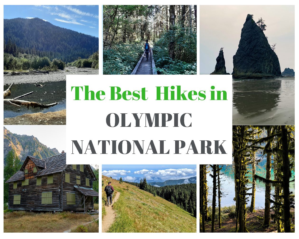
The Best Hikes in Olympic National Park by Region
This post contains affiliate links. That means I may earn a small commission at no extra cost to you, if you buy through my site. I appreciate your support of my site.
Do you want to hike up a mountain, stroll along the coastline, visit a rainforest, and hike through a forest? It can be hard to choose the perfect hiking destination, but at Olympic National Park you don’t need to!
Olympic National Park on the Olympic Peninsula of Washington state is full of different ecosystems. While it takes over 6 hours to drive the main loop around the Olympic Peninsula, you can hike in different regions all within one park. With beach hikes along the Pacific coastline, a temperate rainforest on the west side, glacier capped peaks in the north, and forests on the east side, Olympic National Park is one of the most diverse national parks.
I only had a few days in Olympic National Park and it was not nearly enough time to hike in all the different regions of the park. With the help of my fellow bloggers I put together a review of the best hikes in Olympic National Park by area.
If you have a week or two to slowly road-trip your way around the peninsula you’ll be able to check out all the best hikes in Olympic National Park. If not, choose an area or two and pick a few hikes to get a taste of this awesome place.
Arrive prepared and know what to bring in your day pack and what to wear hiking.
The Best Hikes in Olympic National Park
These Olympic National Park hikes are organized by location. They start in the northeast of the peninsula and then go counterclockwise around the park.
The best places to stay in Olympic National Park in each region are also included. Be aware that prices fluctuate quite a bit by season. A basic budget motel may be $60 a night in the winter, but $300 a night in the summer.
Northeast
Sequim is a great place to start your Olympic National Park hiking adventures. The Olympic Peninsula deserves more than a day trip from Seattle, but if you want to add a day trip to your Seattle itinerary then this is the easiest region to visit.
- Camping: Deer Park Campground is a great place to camp in a tent if you are planning to hike Maiden Peak. The campground is open June-October on a first come, first serve basis.
- Budget: Sequim West Inn provides basic accommodations directly in Sequim. Rooms come with a microwave and a refrigerator.
- Mid-Range: Red Lion Inn & Suites has a daily breakfast and an indoor pool.
- Higher End: Lavender Castle is a unique self-catered rental home with a hot tub.
Maiden Peak

Written by Breanna from The Golden Hour Adventurer
- Distance: 7.5 miles round-trip
- Elevation: 1,700 ft
- Difficulty: Moderate
- Restrooms: Pit toilet at Obstruction Point/Deer Park Trailhead
- Parking: 10 – 15 spaces in a dirt lot near Deer Park Ranger Station
Maiden Peak is one of the best hikes in Olympic National Park (especially in the summer!) due to the panoramic views of the Olympic Mountains, including Mt. Deception and Mt. Cameron.
When navigating to the trailhead, you’ll take Deer Park Road. It’s about 8 miles of gravel with narrow turns and steep drop-offs. We arrived safely in a sedan, however, be sure to drive slowly and cautiously.
You’ll spend the first two miles in the subalpine forest. We spotted plenty of snowshoe hares rustling in the bushes. Then an open field of wildflowers, that color the base of Green Mountain, will greet you. The climb becomes more steep as you make your way to Maiden Peak.
You won’t complain about your barking calves as you take in the view of the snow capped mountains and watch the marmots and chipmunks scamper across the trail. Remember to not touch or feed wildlife.
Although we did not go around Maiden Peak, we lounged at the saddle instead. It overlooked Port Angeles, Vancouver Island, and Mount Baker in the distance. Enjoy a well deserved break and picnic lunch here before starting your journey back to the trailhead.
Dungeness Spit Trail

- Distance: 10.2 miles roundtrip
- Elevation: 137 ft
- Difficulty: Easy
- Restrooms: At the trailhead and at the lighthouse (the halfway point).
- Parking: Mid-sized parking lot at the trailhead that can fill up later in the day.
This trail is not one of the best trails in Olympic National Park. That doesn’t mean it isn’t an awesome trail, just that it isn’t part of the national park! Located only a 15 minute drive from Sequim on the northeast corner of the Olympic Peninsula, it is a beach trail in the Dungeness National Wildlife Refuge that you shouldn’t miss.
The Spit Trail begins with a .63 mile trail through the forest. The shaded trail has plenty of benches and opportunities to spot some wildlife. The section ends with a couple of overlooks followed by a short, but steep downhill to the beach.
The remainder of the trail is on the spit, a narrow stretch of sand that juts out in the water. You can dip your toes in the water or even walk barefoot along the shore. If you are lucky enough to hike on a bright blue sky day you will be treated with beautiful views of both the water and the sky all around you.
You can walk all the way to the lighthouse or turn around at any point. Remember the only way back is on foot and you must be back by sunset. Be aware of the tide times which are posted at the trailhead. The lighthouse has picnic benches, water, restrooms, and a small museum about the lighthouse and the history of the area.
While the trail isn’t part of the national park, it is a national wildlife refuge so you are able to use your America the Beautiful annual pass to enter.
Hurricane Ridge
This section of the park is one of the most popular as it is easily accessible from Port Angeles, one of the quickest places to reach from Bainbridge Island. Start at the Hurricane Ridge Visitor Center to learn more about the park and all the Olympic National Park hikes in this area.
- Camping: Heart O’ the Hills Campground is a national park campground that is closest to the Hurricane Hill hikes.
- Budget: AirCrest is a nice motel with a refrigerator and microwave.
- Mid-Range: Red Lion Inn is newly updated and located right on the water.
- Higher End: Treehouse on the Water is actually as the name implies, an awesome treehouse with views of the Salish Sea.
Hurricane Hill

Written by Val from Voyages with Val
- Distance: 3.8miles round-trip
- Elevation: 826 ft
- Difficulty: Moderate
- Restrooms: None at the trailhead, but restrooms at the nearby Visitor Center.
- Parking: Yes, but it fills quickly. There is also overflow parking.
Hurricane Hill is one of the best and most accessible trails on Hurricane Ridge. Its epic views make it a must see on your Olympic National Park itinerary! This hike is mostly paved, but still quite steep, so be prepared for a workout!
On the hike up you will see the beautiful Olympic Mountain Range and, in the summer, a wildflower display. When it is less crowded you may even see deer, marmots, and other wildlife! At the top you can see all the way to Vancouver Island, as well as the Olympic Mountains’ prominent peaks!
Always leave no trace when visiting these places. Stay on the trail, don’t pick wildflowers, and take out all of your trash and food! Bring plenty of water, as this trail has little shade.
Lake Crescent
This glacier carved lake is a popular spot to visit in the park. Many of the top hikes can be found around the lake.
When choosing where to stay in Olympic National Park, staying around Lake Crescent is one of the best areas. It’s well located near a variety of other things to do.
- Camping: Fairholme Campground is a good spot for easy first-come-first-serve camping.
- Mid-Range: Log Cabin Resort just down the road from the Devil’s Punchbowl trail is great if you would like more facilities.
- Mid-Range: Lake Crescent Lodge offers beautiful views of the magical lake, close proximity to hiking trails, and a nice place to rest your head after a long day of exploring.
Marymere Falls

Written by Stephanie from History Fan Girl
- Distance: 1.7 miles round-trip
- Elevation: 298 ft
- Difficulty: Easy
- Restrooms: At the Storm King Ranger Station parking lot near the trailhead.
- Parking: Lot near the Storm King Ranger Station
The Marymere Falls hike is the most popular hike near Lake Crescent, as it’s easy, less than two miles out and back, and ends at a stunning waterfall. Combine this with its route through an old-growth forest, and you can see why this is a quintessential Olympic National Park day hike.
The trail leaves from the Storm King Ranger Station at Lake Crescent. You wind along the lake before heading through a tunnel under the road and into the forest. Most of the trail is flat dirt, well-marked, and covered with hemlock, fir, cedar, and alder trees.
As you near the falls, you’ll find a few short bridges to cross and stairs leading up to the fall’s two viewing platforms. This section can get slippery, so wear shoes that have some traction!
This part of the Marymere Falls trail is also part of the more challenging Mount Storm King Trail, so adventurous hikers can combine Mount Storm King with a stop at the falls.
An alternative trailhead for Marymere Falls leaves from Lake Crescent Lodge.
Mount Storm King

Written by Kassidy from The Hiking Helper
- Distance: 4.1 miles round-trip
- Elevation: 2,100 ft
- Difficulty: Hard
- Restrooms: at the trailhead
- Parking: A large lot shared with several trailheads.
As one of the best hikes year round in Washington state, Mount Storm King has a whole lot to offer hikers. Although it’s pretty tricky, and you’ll be walking uphill for almost the entire way, the views at the top are more than worth the effort!
Walk through the forested mountain before the trees open up to reveal a steep incline that you’ll need to climb. Ropes are strung along the incline to help, and it’s recommended to bring gloves along. Traverse a few more steep inclines and cross a few boulder patches before you’re greeted with a magical view of Lake Crescent from above.
Enjoy the cool breeze on your face, listen to the birds chirp above you, and revel in all of that hard work that you just put in. Look around at the fjord-like hills that surround the fabulous Lake Crescent, before heading back down the way you came.
Hiking Mount Storm King is a great way to get out any time of year in Olympic National Park, especially on a spring-time hike, when the crowds are few and far between.
Devil’s Punchbowl via Spruce Railroad Trail

Written by Nina and Garrett from Washington is for Adventure
- Distance: 2.4miles round-trip
- Elevation: 144 ft
- Difficulty: Easy
- Restrooms: Vault Toilet
- Parking: Gravel Lot
Hiking to Devil’s Punchbowl on Lake Crescent is actually just the start of this hike, but it’s where most people turn around. If you’re up for it, you can continue hiking for a round-trip hike of 11 miles!
The good news is the path is easy, and you don’t have to hike that far to reach one of the best parts, The Punchbowl! The Punchbowl is a large amphitheater-like rock formation that was created by a massive landslide. The Punchbowl is filled with a deep pool of crystal-clear water and is a popular spot for swimming and picnicking.
To get there, you’ll hike on a beautifully forested paved path that skirts the lake. Eventually, you’ll find a curious old railroad tunnel where you’ll detour towards the left. This is where you’ll find a nice bridge that hovers right over the thundering punchbowl. You may even see a brave soul jumping off the bridge into the freezing cold water.
You have a choice at this point of the trail. You can stay, enjoy, and maybe even take a swim. Continuing along the path will bring you to more beautiful points along Lake Crescent. Turning back and making some time for other epic hikes in Olympic National Park is another option!
Sol Duc Valley
The Sol Duc Valley is in the northwest region of the park. The valley is full of beautiful hikes in an old-growth forest and along the Sol Duc River.
- Camping: Sol Duc Campground includes both tent and RV sites with close access to the amenities at the resort.
- Higher End: Sol Duc Hot Springs Resort is one of the few accommodations directly in the park. If you’re able to snag a room, you’ll get the perks of on-site hot springs.
Sol Duc Falls

Written by Megan from Let’s Jet, Kids!
- Distance: 1.6 miles round-trip
- Elevation: 226 ft
- Difficulty: Easy
- Restrooms: Vault toilet at trailhead
- Parking: Decent sized trailhead parking lot that can fill up quickly in the busy months.
One of the best Olympic National Park hikes is definitely Sol Duc Falls. Rated easy at only 1.6 miles roundtrip, even kids can do this hike!
The hike itself provides lush greenery and even a teaser waterfall area that is gorgeous. The real treat is at the end where you are greeted by three separate, but cohesive waterfalls. They are surrounded by the forest and seem to flow through the rock.
Enjoy the view from the wooden platform. Do not try to climb down to the falls!
High Divide Trail

Written by Kristen from Bear Foot Theory
- Distance: 18.2 mile loop
- Elevation: 3,050 ft
- Difficulty: Moderate
- Restrooms: Vault toilets are available at Sol Duc Park, Heart Lake, Lunch Lake, and Deer Lake. The NPS asks hikers not to urinate in vault toilets to prevent them from filling too quickly.
- Parking: at Sol Duc Trailhead
The High Divide Trail is one of the best backpacking routes in Olympic National Park and is a great way to get off the beaten path during an Olympic National Park road trip. The 18+ mile loop traverses through lush temperate rainforest, along stunning ridgelines with views of Mount Olympus, and across the Seven Lakes Basin studded with crystal clear alpine pools. There’s also the chance to see wildlife, including black bears.
The loop can technically be done in a day if you’re an experienced and very fit hiker, but most people choose to spend 2-3 nights on the trail to fully take advantage of the lakes and scenery. There are designated campsites along the loop, and advanced permits are required to hike the trail. If you want to make the most of your time in the Seven Lakes Basin, there are several side trips off the main loop that you can take including Hoh Lake, Lunch Lake, and Appleton Pass.
The best time to hike the High Divide Loop is during the summer months between May through September. You should be prepared for all types of weather.
Pacific Coastline
You’ll find some of the best hikes in Olympic National Park along the Pacific Coastline.
- Camping: Lake Ozette Campground is a NPS campground located next to the trailhead. The campground is definitely the closest place to stay for the Ozette Loop Trail.
- Camping/Budget: The Lost Resort at Lake Ozette has camping spots that don’t need reservations and basic cabins with beds, pillows, and linens provided.
- Budget: Curley’s Resort in Sekiu is 40 minutes away from the Ozette Loop trailhead.
- For Rialto Beach see suggestions in Forks below.
Ozette Loop Trail

Written by Taryn from Happiest Outdoors
- Distance: 9.2 mile loop
- Elevation gain: 164 ft
- Difficulty: Easy
- Restrooms: A pit toilet at the trailhead as well as at Cape Alava and Sand Point along the trail.
- Parking: gravel parking lot at the trailhead.
The Ozette Loop Trail is one of the best hikes in Olympic National Park to enjoy the remote wilderness coast. The loop trail is shaped like a triangle with two sides in the coastal rainforest and one along the ocean. The section along the coast has no trail – you just follow the beach, which means you need to consult a tide table and go at low tide to get around a few rock outcroppings.
You will also want to visit at low tide to explore the beautiful tide pools and rock formations. Keep an eye out for the Indigenous petroglyphs at Wedding Rocks. It’s easy to complete the hike in 4-5 hours, but to really savor the scenery, book one of the three backcountry campsites. They all have incredible views of the sun setting into the ocean.
Rialto Beach to Hole-in-the-Wall

Written by James Ian from Parks Collecting
- Distance: 3.3miles round-trip
- Elevation: 0 ft
- Difficulty: Easy
- Restrooms: At the entrance to the beach in the parking lot.
- Parking: Reasonable-sized parking lot at the entrance to the beach/ the start of the hike.
Rialto Beach is one of the most beautiful beaches in the Pacific Northwest and Olympic National Park. The edge of the beach is strewn with driftwood the size of tree trunks. The beach is sandy and a little rocky and immediately off the coast are sea stacks, large rocks poking out of the ocean. This makes for very dramatic scenery. It also makes for a really great hike along the beach.
From the parking lot, go straight out onto the beach and turn right. Walk along the beach, enjoying the driftwood on your right, and the sea stacks on your left. After about a mile and a half, you will come to two very large sea stacks, poking straight out of the beach at low tide. A short distance past this you will see the famous hole-in-the-wall.
This is an outcrop with a large hole in it, as the name implies. At low tide, the area is surrounded by rock pools that are great for exploring. You will often see star fish, sea anemones, and mussels.
Go through the hole in the wall and turn around and you can perfectly frame the pointy sea stack in the arch created by the hole in the wall. It makes a great photo.
When you’re finished exploring head back to the parking lot. Keep in mind that this hike is best at low tide, so always check the tide charts before setting out. Then you will have the best chance of exploring the rock pools.
Hoh Rainforest
Temperate rainforests are only found in a few locations around the world. The Hoh Rainforest is one of the largest temperate rainforests in the USA. Rain falls frequently, especially in the winter months, creating a vibrant canopy of greenery.
Forks is the closest town to the Hoh Rainforest. It’s about a 50 minute drive one way to the visitor center. The small town has a limited number of accommodations, most of them are basic motels.
- Camping: Hoh Campground is near the Hoh Rainforest visitor center with 72 spots. You can reserve online at recreation.gov.
- Budget: Town Motel is a simple motel in Forks that provides good, clean accommodations for a night or two. There is no breakfast included and the wifi is a little spotty.
- Mid-Range: Miller Tree Inn Bed and Breakfast, a cute farmhouse turned inn with individually decorated rooms and a large front porch, is one of the nicer places to stay in Forks.
Hoh River Trail to 5 Mile Island

- Distance: 10 miles round-trip
- Elevation: 387 ft
- Difficulty: Easy to Moderate
- Restrooms: Outside of the visitor center at the trailhead. Rustic outhouse at 5 Mile Island.
- Parking: Visitor Center parking lot. It can fill up quickly and you may need to park on the street or in the overflow parking lot.
The Hoh River Trail is one of three trails within the Hoh Rainforest. At 38 miles round-trip it is the longest trail. Many people spend several days on the trail and camp along the way.
Most of the trail is fairly level and smooth. There are some parts with tree roots, but overall it’s a nice trail to take in the unique greenery around you. A small waterfall and views of the Hoh River along the way also offer beautiful scenery.
If you are looking for a day hike, plan to hike to 5 Mile Island. You can turn around at any point, but this is a good stopping point. The open area along the water is the perfect spot to rest and have a bite to eat before returning back.
The Hall of Mosses

Written by Ashley from Create Your Own Roadshow
- Distance: .8 mile loop
- Elevation: 100 ft
- Difficulty: Easy
- Restrooms: Outside of the visitor center at the trailhead.
- Parking: Visitor Center parking lot. Spots are limited so you’ll want to get there early.
Hall of Mosses is one of the classic Olympic National Park hikes. This part of the park is known for its lush temperate rainforest and Hall of Mosses is the most epic example of this. In this short loop, you will be surrounded by moss draping from every tree. It is truly a beautiful example of mother nature’s decorating skills.
To get to the trailhead, you will take the 101 south from Forks and turn east on Upper Hoh Rd for 18 miles. Parking is limited so you’ll want to keep this in mind when planning the timing of your hike. Though it may be crowded due to its popularity, this hike is a can’t miss on any visit to Olympic National Park.
Quinault Rainforest
Within the southwestern part of the park is another temperate rainforest. It’s often not as busy as the Hoh Rainforest.
- Camping: Graves Creek Campground, right at the trailhead, is the best place to stay for the Enchanted Valley Trail.
- Mid-Range: Lake Quinault Lodge is one of the park’s historic lodges.
Enchanted Valley Trail

Written by Matt and Alysha from Wheatless Wanderlust
- Distance: 26 miles round-trip
- Elevation: 3,700 ft
- Difficulty: Hard
- Restrooms: None at the trailhead, but multiple vault toilets along the trail out to the valley and in the valley.
- Parking: Small lot at the trailhead, and additional parking along the road.
The Enchanted Valley Trail in Olympic National Park meanders through a lush section of old growth rainforest. Follow the East Fork of the Quinault River until you reach the vast Enchanted Valley, with its high rock walls towering above you. Along the way, you’ll encounter thick, bright green ferns and a winding river. If you’re lucky you’ll glimpse the elk and black bears that call this section of rainforest home.
Thousands of travelers visit the Hoh Rainforest every week to get a taste of the temperate coastal rainforest that thrives in this corner of Washington State. You’ll encounter a mere trickle of people on this trail, which features an equally impressive rainforest.
The often photographed Enchanted Valley Chalet was once a much needed refuge for travelers passing through. Now abandoned, it is the focal point of the valley.
This is not a day hike. It is an overnight trip that requires at least two nights on the trail to make it pleasant. It’s a fairly gradual climb, but it is a long hike from the trailhead out to the valley.
If you’re up for a couple of nights of backpacking, it’s one of the best things to do in Olympic National Park. There are five campgrounds along the trail, including the campground in the Enchanted Valley itself, and several campgrounds have pit toilets available to use. The trail follows the East Fork of the Quinault River for most of the journey, which is going to be your main water source for the trip.
Thanks to the help of my fellow bloggers you can now choose the best hikes in Olympic National Park! If you are looking for another great place to hike in the Pacific Northwest, visit Crater Lake National Park in southern Oregon
More in the Pacific Northwest
- Olympia: Fun Things to Do
- Oregon: Crater Lake National Park Hikes & Viewpoints
- Portland: Donuts, Food Cart Pods, 3 Day Itinerary
- Seattle: 4 Day Itinerary
Pin IT!!