
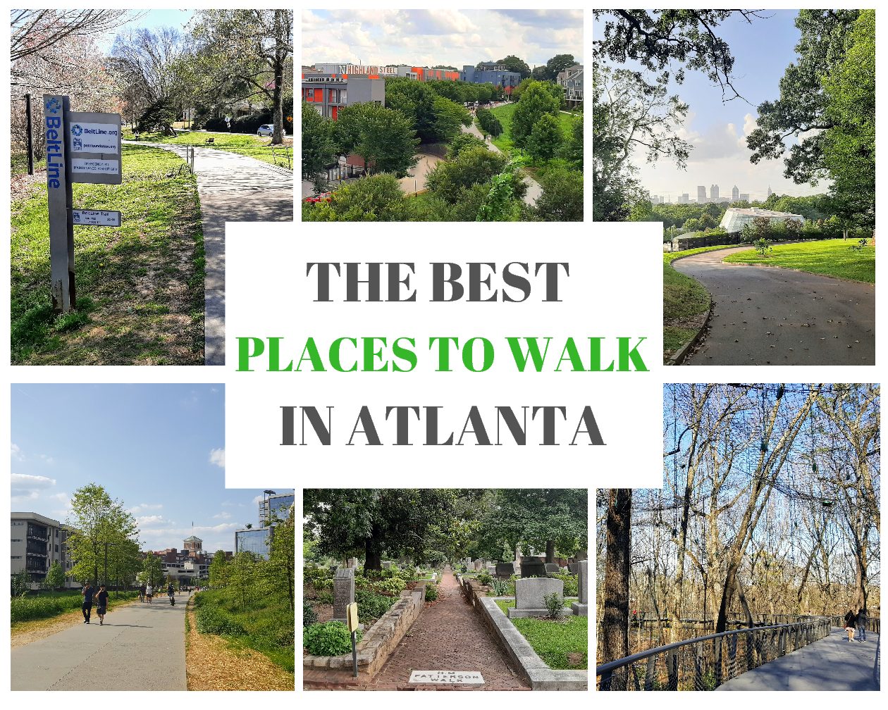
The Best Places to Walk in Atlanta
Updated January 11th, 2022
This post might contain affiliate links. That means I may earn a small commission at no extra cost to you, if you buy through my site. I appreciate your support of my site.
Did you know that Atlanta has the most green space per person? The study run by GeoTab ranked Atlanta #1 out of 15 major US cities. You don’t have to look far to find parks, nature preserves, and walking trails in Atlanta.
As you will see below you can stay in the city and find nice places to walk, but if you are looking for more hikes near Atlanta you don’t need to drive for long. Head north only a few miles and you will find the Chattahoochee River trails. There are over 66 miles of trails along the riverbank.
For this post we are going to stick to places to walk in Atlanta. When I say “in Atlanta” I actually mean ITP (in the perimeter – within the city). There’s nice hiking around the city, but Atlanta actually has quite a few popular spots and hidden gems that are ideal for walkers both living in and visiting the city. These walks can easily be added to a 3 day Atlanta itinerary.
The Best Places to Walk in Atlanta
I have spent a lot of time in Atlanta the last couple years. A great deal of that time has been checking out the best places to walk in Atlanta!
Visiting information such as restrooms, parking, and public transportation directions are given for each place. The public transportation directions are written as if you are traveling from Midtown and leaving from the Midtown Transit Station. If you are visiting the city stay in Midtown so you have easy access to all of these walks and the other great attractions nearby.
Use my Atlanta restaurant post and map to find handy restaurants near all of these places to walk around in Atlanta.
Walking Trails in Atlanta
The walking trails in Atlanta are mostly paved and cover a lot of ground. If you are trying to get around the city without a car or public transportation walking on one of the two trail systems below is your best bet.
The BeltLine

Atlanta’s BeltLine is a 22 mile loop that is being created over an old railway corridor. Once completed it will be a paved multi-use trail for walkers, runners, and cyclists. It will connect 45 in-town neighborhoods and make some of the most walkable neighborhoods in the city even more accessible. As Atlanta isn’t known as one of the most walkable cities, the BeltLine is a huge asset to the city. I’m a big fan of the BeltLine and love how it is transforming Atlanta.
Another goal of the BeltLine is to provide a space for public art. There are many sculptures and murals along the trails, especially on the Eastside & Westside trails. The majority of Atlanta’s official Tiny Doors are located on the trail or in the neighborhoods along the trail.
In addition to the BeltLine being one of the best places to walk in Atlanta, it’s also home to some of the best restaurants.
This urban trail is broken up into sections. There are some additional interim and connector trails, but the following are the main sections that are fully or partially open now.
Eastside Trail
The Eastside Trail is a fully complete 3.5 mile section of the BeltLine that runs from the southern tip of Piedmont Park in Midtown to the neighborhood of Glenwood Park. It passes through Virginia Highland, Old Fourth Ward, and Inman Park. Several access points along the path encourage you to get out and explore these neighborhoods which are all very safe and walkable. On the weekends this section is packed.
There are so many different options for restaurants along this section. They are all marked on my BeltLine restaurant map. Ponce City Market and Krog Street Market are both good choices. They make for a convenient stop if you just need a restroom as well. The Atlanta Bicycle which offers bicycle rentals is located along this stretch.
A BeltLine walking tour is a nice way to explore the area and learn more about the art and green spaces.
Southside Trail
The Southside trail begins in Glenwood Park. Currently it is open, but it is not completed. The trail has yet to be paved. I wouldn’t recommend riding a bike on this section, but it isn’t a problem to walk here. Trust me you are in for a very bumpy ride if you attempt the trail on a bicycle! On the plus side it is quite a bit less crowded than the Eastside trail.
There is nowhere near the number of restaurants along this section as there is on the Eastside Trail. The Beacon is a newer indoor/outdoor space with restaurants, retailers, and wellness businesses. It has a very up and coming vibe and handy for a bathroom stop if needed.
As of this writing the trail is closed at Pryor Rd. It is blocked off and you have to walk on University Ave SW until the avenue runs into the Westside Trail. There is about 2.7 miles of the trail open now and it will be about 3.9 miles total when completed.
Westside Trail
This section of the BeltLine is paved and finished. The trail runs for about 3 miles through some of Atlanta’s oldest neighborhoods. These areas are beginning to be developed more with some places to eat along the BeltLine, such as the cluster of breweries near the start of the Westside Trail.
Northside Trail
The Northside Trail runs through Tanyard Creek Park. Walking this trail you feel like you are in nature much more than other parts. With an old covered wooden bridge and a small stream trickling along near the path it is a very scenic walk. The trail goes for about a mile before connecting with the Atlanta Memorial Park. For more walking in the area, continue on the paths and trails within the park (described below).
Northeast Trail
Along the eastern side of Piedmont Park you can find the Northeast Trail. It connects with the Eastside trail, but is narrower in many parts and unpaved. There is about .8 miles of the trail currently opened. The access points here are not as frequent and handy.
PATH

The PATH trails are also paved multi-use trails that have been created over old railway corridors. Unlike the BeltLine, the PATH trails cover a lot more ground throughout Georgia. Altogether there are about 300 miles of trails! The majority of the trails go in or around Atlanta. Several connect with each other or with sections of the BeltLine. Many of the sections do not get as busy as the BeltLine. There seems to be more bikers than walkers on some parts of the trail.
Similar to the BeltLine the mission of the trails was to connect the city and provide more linear green spaces. There is around 30 different trails to choose from. I will recommend one walking trail in Atlanta that is centrally located and runs through several in-town neighborhoods.
Stone Mountain PATH & Freedom Park
The Stone Mountain PATH begins in downtown Atlanta and continues for 19 miles until it reaches Stone Mountain. The section between the Jackson Bridge and Candler Park is about 2.7 miles. First you can take the iconic Atlanta skyline photo from Jackson Bridge and then continue on the PATH through the linear Freedom Park.
The Martin Luther King, Jr. National Historical Park with his house, outdoor grounds, and indoor exhibits is a few blocks from the Jackson Bridge. The Jimmy Carter Presidential Museum & Library is further along the path in the middle of the park. Near the museum the park makes an X shape with paths that go in all four directions. At this spot you can also connect with the BeltLine and many of the neighborhood restaurants. Artwork and historical sign markers are a big part of this section of the trail.
Parks & Gardens in Atlanta
It seems like there is a park in Atlanta around every corner. Many of them are smaller neighborhood parks. The parks below include some of the nicest and biggest community and regional parks in Atlanta. They lend themselves well to city walks on mostly paved trails. They provide a great way to remove yourself from the traffic noise of the city, but also offer safe, more populated walks for solo walkers who don’t want to feel like they are alone in the woods.
Chastain Park

At 268 acres Chastain Park in Buckhead is Atlanta’s second largest park. The majority of the park is full of various sporting fields and grounds. There’s a pool, a horse park, numerous baseball fields, tennis courts, and more. On the north end of the park a really nice playground attracts children of all ages. Let’s be honest I would have totally checked it out myself if there weren’t so many children frolicking about!
Around the perimeter of the park is a 3.4 mile “big loop”. It is a paved trail that runs parallel to the streets for most of the way around the park. There’s also a “short loop” 2.7 mile trail that runs the same path for the majority of the trail and then cuts across the park further south than the “big loop” trail. The loops are mostly on flat ground and make for a really easy city walk in Atlanta. I found the east side to be nicer with a little more distance between the path and the cars. It also felt more woodsy with a couple of bridges and areas to sit on a swinging bench overlooking a creek. These perimeter paths are quite busy with walkers and runners though.
Just past the amphitheater you can continue on the marked red loop, or take a smaller, more hidden woodsy trail that hugs Hamburger Pond. The swinging bridge next to the pond makes for a nice place to rest for a few minutes and watch the ducks. The trail then continues through the woods for another couple minutes. Chastain isn’t the place to go if you are looking for nature trails in Atlanta, but if you are at the park make sure to find this trail.
Restrooms: This map shows the public restrooms. Restroom opening hours depend on which sporting facilities are open. Your best bet are the restrooms next to the playground, #12 on the map (this restroom for some reason is not marked on the map).
Parking: Free parking at lots in the park (use the above linked map)
Public Transportation: Take the MARTA Red or Gold line to the Lindbergh Transit Station. From there take the #5 bus to Roswell Rd NE & Land O Lakes Dr NE and walk about 11 minutes to the SE corner of the park. Alternatively stop at Roswell Rd NE & Dilbeck Pl NW. Walk about 17 minutes to the NE corner of the park.
Westside Reservoir Park

Move over Chastain Park, there’s a new bigger Atlanta park! Westside Park at 280 acres is now Atlanta’s largest park. While it is the biggest in acreage, it definitely didn’t seem like the biggest in regards to walking paths. The longest loop, the purple loop, is 1.35 miles. The other loops share much of the same path of the purple loop and are .30 – .97 miles.
All the paths are paved and many of them are wheelchair accessible. The map marks which ones are not ADA compliant. Overall the maps located all around the park are well done and easy to read. They clearly mark all trail paths with mileage and all the other amenities in the park.
A great deal of the park is taken up by the reservoir. This large body of water provides emergency drinking water for the city. At 400 feet deep, it goes down so far that the Statue of Liberty could stand in the water without reaching the top! There’s a viewpoint and a short trail along the rim. You can get good views of the water, but won’t be able to get too close.
The Proctor Creek Greenway, a PATH trail, also runs through the park. This is your best bet if you want a longer, less crowded trail. It is also more remote and full of greenery. To the west it runs for about .8 miles to Johnson Rd, where it turns into the River Park Trail for another .6 miles. In the opposite direction it goes for about a mile to the Bankhead Station.
Restrooms: There are restrooms at both parking lots as well as at the playground. They are well marked on the map and easy to find.
Parking: Free parking at the two main parking lots off of Johnson Road NW. (1660 Johnson Rd NW & 1600 Johnson Rd NW)
Public Transportation: You can take the #14 bus from the Midtown Transit Station to Huff Rd NW & Ellsworth Ind Blvd. You will need to walk about 21 minutes to the main park entrances. It takes longer, but you could also take the #12 bus or the red/gold line and connect with the 26 bus and then you only need to walk 5 minutes to the park.
You can also go to the Bankhead Station and enter the park from the south on the Proctor Creek Trail.
Atlanta Memorial Park

Atlanta Memorial Park in Buckhead is another one of the larger Atlanta parks. It is made up of two sections. One to the east of Northside Drive and one on the western side. The portion to the east is a large green space that is mostly filled with the Bobby Jones Golf Course and the Bitsy Grant Tennis Center. BeltLine Connector trails form a ~2 mile loop around this section of the park. Sidewalks run fairly parallel to the street on some sides of the park. Other sides, specifically the southern side the trail is pavement and inside of the park.
You can easily connect to Tanyard Creek Park and the Northside Beltline Corridor from here. This part of the park reminded me of the bigger Chastain Park also in Buckhead. It didn’t feel quite as crowded as Chastain though.
To the west of Northside Drive the park is narrow and curving. Sidewalks around the perimeter of this section of the park provide a nice ~1.8 mile walk. For a slightly more woodsy experience walk on the nature trail within the park. It runs along the south side of Peachtree Creek for the length of this section of the park. Here you can also find a playground and some open green space. Take a look at the trail map.
Restrooms: I asked and was able to use the restrooms inside of the Bitsy Grant Tennis Center. They are open Monday – Friday (9AM – 9PM) and Saturday & Sunday (9AM – 6PM). The Murray Golf House with the Boone’s Restaurant probably has restrooms as well.
Parking: Parking garage near the golf center. Also a lot of residential street parking surrounding all sides of the park.
Public Transportation: The #12 bus that runs along Howell Mill Rd NW where you can stop at Peachtree Battle or one of the stops before that depending on where in the park you would like to start.
Piedmont Park

Westside Park may be the biggest park in Atlanta, but Piedmont is the most popular and seems like it has more trails than the Westside Park. Located between Midtown and Virginia-Highland and on the BeltLine trail the park is very convenient to reach. Piedmont Park is the Central Park of Atlanta. It has everything you could want from a park. It really is one of the best Atlanta parks.
If you are looking for a paved running or walking trail in Atlanta look no further than Piedmont Park. The active oval loop and the meadow path both make for good looping trails. You can combine them with other trails and get a ~4 mile loop covering different sections of the park. In the northern end of the park there are narrower unpaved trails in a woodsier area.
There are wide open fields for sports, picnicking, and sunbathing. Several sporting facilities and fields along with playgrounds also fill the park. Many swinging benches can be found throughout the park. They are perfect for a rest after many hours of activity. Piedmont Park is the perfect city park. It’s a way to become lost in nature, while still admiring the Midtown skyline.
It’s a fantastic park, but everyone knows it. That means you won’t be alone here! It’s funny you can walk through some parts of Midtown on the weekend and see very few people on the sidewalks, but as soon as you hit the park there are people everywhere!
Restrooms: About seven different locations around the park. They are open from 8am – 6pm.
Parking: A paid parking garage is right in the park (1320 Monroe Drive). If you are willing to walk a bit you can find free street parking in the residential Virginia Highland neighborhood to the east of the park.
Public Transportation: The SW corner is only about a 15 minute walk away from the Midtown Transit Station.
Grant Park

The biggest parks and the most popular park in Atlanta have been mentioned. Now on to the oldest city park, Grant Park! It was a gift to the city in 1883 by Lemuel Grant. The park isn’t as as popular as Piedmont, which also means it is not as crowded. There’s a nice local feel to the park with families out for a picnic on the weekends, joggers running in the evenings, and couples taking their dogs for a walk.
If you walk around the perimeter of the park on the sidewalks it is about a 2.2 mile walk. Between Cherokee Ave SE and Boulevard SE is a bit hilly so you may want to consider going the opposite way in order to go downhill. As a side note I find Atlanta to be quite hilly in general, especially for a city so expect some slight climbs every once in awhile.
Within the park there are several curving trails to explore. A portion of the park was recently renovated. A few extra paved trails near the zoo and a new parking lot were added. There is a playground and a few different sports fields. What brings many people to the park is the Atlanta Zoo which takes up the majority of the lower half of the park. Visit the zoo for free with the Atlanta City Pass.
Grant Park is located within the historic neighborhood of the same name and is a good neighborhood to explore as well. Before leaving the park itself don’t forget to find the two Tiny Doors!
Restrooms: Located in a small gray building near the entrance to the zoo. You do not need to have a ticket to the zoo to use the restrooms.
Parking: Paid parking lot near the zoo entrance off of Cherokee Ave SE and in the new Grant Park Gateway parking ramp on Boulevard SE. Both are $3 an hour. Alternatively there is a lot of free residential street parking available in the area.
Public Transportation: Take the MARTA Red or Gold line to the Five Points Station. Then walk to Marietta St NW & Broad St where you will take bus #186 to Hill St SE & Woodward Ave SE. Walk about 13 minutes to the NW corner of the park.
You could also take the MARTA Blue/Green line to King Memorial Station and walk about 20 minutes to the northern end of the park.
Oakland Cemetery

In truth Oakland Cemetery is actually Atlanta’s oldest public park! In 1850 six acres were bought to create the cemetery. At the time the city of Atlanta bought the land for the cemetery it was located outside of the city limits. The cemetery grew to 48 acres after the Civil War. In the late 1800s the cemetery was more than a place people would go to bury their loved ones. It was a pleasure garden where people would take leisurely walks around the garden plots. The garden plots were maintained by family members and varied from plot to plot.
Now the cemetery is surrounded by the residential areas of Grant Park, Cabbagetown, and Sweet Auburn. After several decades of neglect the cemetery in the late 1900s once again was a place people go for a stroll. Today it is still one of the nicest places to walk in Atlanta and still has gardens kept in the style of the earlier years.
As you can imagine there is a lot of history to the cemetery. It is divided into different areas dedicated to different groups of people. For example there is a section for African Americans and another for Jewish individuals. Many famous residents are buried in Oakland Cemetery, including the author of Gone with the Wind, Margaret Mitchell.
You can walk through the cemetery on your own, listen to the “African American Voices” cell phone tour, or take a guided walking tour. Many other special tours and events take place throughout the year including several Christmas events.
Restrooms: Restrooms at the visitor center. Public restrooms are also available across the street at the Larkin near the parking garage.
Parking: Free in the small lot outside the main gate on MLK Jr Dr SE.
Public Transportation: Take the Red or Gold line to the Five Points Station. Then take the Blue or Green line to King Memorial Transit Station.
Atlanta Botanical Gardens

Just next door to Piedmont Park is the Atlanta Botanical Gardens. It’s the perfect place to go if you are hoping for a shorter, leisurely walk in beautiful surroundings. Storza Woods makes up about 1/3 of the gardens. This woodland area with a canopy walk and boardwalks is one of the best places to walk within the gardens. At 40 feet in the air the Kendeda Canopy Walk provides a unique view of the flora below.
While I found the Storza Woods to be the nicest and most tranquil area of the gardens, the rest of the gardens are lovely as well. Right outside of Storza Woods is the Cascades Garden with the Earth Goddess which is also a very relaxing spot. If you have ever seen a photo of the Atlanta Botanical Gardens it probably featured the Earth Goddess. She is made up of 18,000 annuals and is the unofficial icon of the gardens. It is one of the many examples of how the gardens combine art and nature.
Of course being the foodie that I am I found the Edible Garden interesting. Speaking of food there are several places here to grab a bite to eat to go or to sit down and enjoy a more relaxed meal.
The Atlanta Botanical Garden has a lot of events and festivals throughout the year. The Scarecrows in the Garden is a great Atlanta fall festival.
Restrooms: Several locations
Parking: A paid parking garage is right at the gardens. It is the same garage as for Piedmont Park, but you enter on Piedmont Ave instead of Monroe Drive. If you don’t mind walking more, you can find free street parking in the residential Virginia-Highland neighborhood to the east of the gardens.
Public Transportation: The entrance is about a 20/25 minute walk away from the Midtown Transit Station.
Mason Mill, Ira B Melton, and Medlock Parks

These three parks are actually Decatur parks and part of the Dekalb County parks system. Due to their close proximity to one another and the connecting trails between them, they are a great place to walk. They contain paved trails, boardwalks, and soft dirt trails.
Mason Mill park is home to really nice playgrounds for both toddlers and older children, a dog park, a community garden, and a recreation center. The DeKalb Tennis Center is also here. What sets Mason Mill apart from other community parks of it’s size is the wooded trails surrounding the park.
The South Peachtree Creek Trail, a PATH trail, connects Mason Mill Park and Medlock Park. This section of the trail is about one mile long and is paved in some sections and a boardwalk over the wetlands in other sections. You can get off the trail and walk some loop and spur trails on dirt and rocky paths.
Medlock Park is full of sporting fields, a playground, picnic areas, and a pool. Ira B Melton park is also nearby. While the park itself has some nature trails, you will need to walk along streets to reach the park from either of the other two parks. It’s about 1 mile from each of them.
Restrooms: At the playground, tennis center, and recreation center at Mason Mill. The pool and recreation center have restrooms at Medlock Park (only available during open hours).
Parking: Free parking at Mason Mill & Medlock Parks.
Public Transportation: There are quite a few options. The easiest is taking the 36 bus from the Midtown Station to N Decatur Rd NE & Princeton Way, but you will need to walk 33 minutes to reach the park. The last 15 minutes is walking on the S Peachtree Creek Trail so it really isn’t that bad and avoids having to make extra transfers on MARTA!
Olmsted Linear Park

If you have heard of Frederick Law Olmsted you probably know him as the designer behind the famous Central Park in NYC. He was involved with many other urban parks including this area of greenspace in Druid Hills. By request of developer Joel Hurt, Olmsted created a plan in 1893 for the area which is now known as Olmsted Linear Park.
Olmsted Linear Park is made up of six Atlanta park segments: Springdale, Virgilee, Oak Grove, Shadyside, Dellwood, and Deepdene. From East to West the quickest route through all the parks is about 2 miles. Each section is named after the natural features found within, except Virgilee which is named after Joel Hurt’s daughter.
The first five segments are known as pastoral segments, areas of open land. They have paved trails surrounded by well manicured grassy areas, trees, and flowers. Most have only one or two paths that run east to west. Deepdene at the eastern end, is the largest with 22 acres. It contains wooded paths winding around a stream and ultimately ends in a large meadow.
Over 100 years ago Olmsted intended these parks to be an oasis for people to leave the pressures of city life behind and enjoy nature. Today his vision continues to flourish thanks to the Olmsted Linear Park Alliance.
Restrooms: No
Parking: No parking available, except nearby street parking.
Public Transportation: Take the MARTA Red or Gold line south to the North Avenue Station. Transfer. Then take the #2 bus towards Druid Hills Ponce City Mkt East Lake Stn. Get off on the Ponce De Leon Ave NE & Moreland Ave NE.
Historic Fourth Ward Park

Named after the Old Fourth Ward neighborhood in which it is located, Historic Fourth Ward Park is about 17 acres. It is the smallest Atlanta park on this list. It’s not the best park for a long walk, but the trails it does have are very nice. Plus it is close to the Eastside BeltLine trail and the PATH Freedom Park trail for additional walking.
The winding paths over and around the central lake make for a nice, quiet stroll. You may even catch some wildlife in the lake. I spotted a turtle last time I walked there.
The park has many amenities such as a playground, splash pad, and amphitheater. Many of Atlanta’s festivals take place within the park. The Historic Fourth Ward Skatepark is also part of the park, but located separately. You can find it right off of the BeltLine.
Restrooms: Yes, by 670 Angier Ave. NE.
Parking: No parking available, except nearby street parking.
Public Transportation: It’s about a 40 minute walk from the MARTA station to the northern end of the park. You can also take the MARTA gold or red line to the North Avenue Transit Station and then walk 28 minutes or take the #2 or #102 bus east the remainder of the distance to Ponce De Leon Ave NE & 675.
Nature Preserves & Wildlife Sanctuaries in Atlanta
Atlanta’s parks are top notch, but if you want that feeling of getting lost in the woods without having to leave the city these nature preserves and wildlife sanctuaries are for you. The first time I visited a nature preserve in Atlanta I couldn’t believe that I could feel lost in the woods in the middle of such a bustling city. Not to mention all of these places are free to visit, both the parking and the entrances!
Cascade Springs Nature Preserve

Cascade Springs Nature Preserve is a foresty area with a beautiful waterfall. It can become crowded around the falls, but once on the trails you can walk for awhile without running into anyone. The preserve is a little bigger than it first appears. There’s a main loop that is about 2.6 miles, but also several side trails. The trails start on a boardwalk, but the majority are dirt trails.
The trails aren’t marked that well. Other than a map at the beginning, there aren’t any signposts or maps on the trail. It is quite easy to get turned around here. We ended up in a mossy green field for a bit. It clearly looked like we were on a trail, but the further we went the less certain we were of that!
Like many hiking areas in and around Atlanta there is some Civil War History here. The Battle of Utoy Creek was fought in what is now the preserve.
Restrooms: None
Parking: Free parking at the main entrance. (2852 Cascade Rd)
Public Transportation: Take the MARTA Red or Gold Line to West End Station. Then take the #71 bus to Cascade Rd SW & Veltre Cir which is right outside the entrance.
Morningside Nature Preserve

Morningside Nature Preserve is a small wooded area with a creek and a couple of connected short trails. A loop from the parking lot and back is about 2 miles. From the parking lot the trail begins at an incline in a wooded section. It then continues through a small meadow, which can be quite hot in the summer. The remainder of the trail is mostly shaded and almost feels like a jungle in parts with all the greenery.
It isn’t a huge area, but it isn’t marked either. If you get a little turned around and go in all directions you can add a bit more distance to your walk. You can also gain a little more distance by walking in the surrounding neighborhood or to one of the many restaurants on Cheshire Bridge Rd.
The boardwalks before and across the stream are nice, but need a little attention in some parts. Along the stream there is a dog beach where dogs and some people swim. I recommend leaving the water to just the dogs though! Be aware dogs sometimes start running through the trails off their leases.
Restrooms: None. Nearby Cheshire Bridge Rd is full of restaurants.
Parking: Free parking lot at 2020 Lenox Rd NE.
Public Transportation: Take the MARTA Red/Gold Line to Lindbergh Center Transit Station. Then take the #6 bus to Woodland Ave NE & Lenox Rd NE and walk about 7 minutes to the entrance.
Elwyn John Wildlife Sanctuary

Except for the main, mostly commercial roads in the neighborhood there are no sidewalks. The Elywn John Wildlife Sanctuary is truly a sanctuary in a busy area that isn’t so pedestrian friendly. The shaded nature trails, mini waterfall, and the small creek serve as a nice oasis from the noise on the streets.
The main ~1.7 mile loop circles the area. Many junctions have a loop trail sign marker pointing the way. Smaller paths veer off and lead to residential areas, including some backyards! If you go the wrong way you will quickly realize it and it won’t take long to retrace your steps.
The Sanctuary is located right behind Kittredge park which features a stadium, pool, and ball fields. The open green space between the park’s facilities and the start of the loop trail makes a nice spot for picnicking or throwing a ball around.
Restrooms: None. There is a Target across the street.
Parking: Free parking
Public Transportation: Take the MARTA Gold/Red lines to the Lindbergh Station. Then take the #6 bus to Lavista Rd NE & Briarcliff Rd NE. You will have to walk about 30 minutes to the Sanctuary.
Herbert Taylor Park & Daniel Johnson Nature Preserve

The park and nature preserve are connected so you can’t tell where one stops and the other starts. The area includes tranquil wooded trails with a creek and a sandy beach area. There’s a nice spot with a bench overlooking the creek. Although it is the middle of a residential neighborhood it feels pretty secluded. It’s an interesting area to walk in. We even stumbled upon a bamboo forest!
There is a map near the Pasedena & Beech Valley entrance. We didn’t look at the map until we were leaving. We attempted to go from SW entrance to the north, which the map showed was possible, but we found the trail ending and it seemed we would be walking in the back of someone’s yard. We may have done something wrong, but it seemed there was no further way to go north. Maybe it was our going in circles, but if felt bigger than it appears.
Restrooms: None, there is a Kroger nearby.
Parking: No parking, but nearby residential street parking available.
Public Transportation: Take the #36 bus to E Rock Springs Rd NE & Markan Dr NE.
Lullwater Preserve

Located on Emory’s campus, Lullwater Preserve has a mix of paved and unpaved trails. Emory’s website describes the preserve as a place for “community members to enjoy”. You can decide for yourself if you are a “community member”!
The scenic trails at Lullwater include various connecting loops such as the lake loop and the hill loop. The hill loop was named correctly as there is indeed a hill. In addition to Candler lake, a suspension bridge, and mini waterfalls add to the beauty of the Preserve. A PATH trail is in the works to connect Mason Mill and Lullwater Preserve.
Restrooms: None
Parking: There’s parking near Hahn Woods.
Public Transportation: Take the #36 bus to N Decatur Rd NE & Clifton Rd.
Now you know where the best walks in Atlanta so start exploring! I hope you enjoy all the parks, nature preserves, and walking trails in Atlanta as much as I do!
More in Atlanta
ACTIVITIES:
ART:
DAY TRIPS:
FESTIVALS & HOLIDAYS:
FOOD:
- BBQ
- BeltLine Restaurants
- Breakfast Restaurants
- Brunch Places
- Burger Spots
- Casual Restaurants
- Chicken & Waffles
- Donuts
- Food Halls
- Healthy Restaurants
- Mystery Picnics
OUTDOORS:
Pin IT!!


8 Comments
Emma
I had no idea Atlanta had so much green space, it looks amazing. I’ve definitely been looking for more green areas and parks this year as walks around the neighborhood get old fast. Love the look of Chastain Park and I’m glad I’m not the only one who walks around cemeteries, always some interesting sights to see there
The Fearless Foreigner
A year ago I had no idea either! It is such a nice contrast from all the interstates and traffic in the city.
ANUKRATI DOSI
That is such an excellent guide. Being a foodie, Eastside trail sounds the most appealing to me. I can’t wait to go there.
The Fearless Foreigner
The EastSide is trail is great!
Elena Pappalardo
What a lovely and well-timed post! Would love to try out some of these Atlanta walks. I’m especially loving Grant Park – such a stunner!
The Fearless Foreigner
Oh are you in Atlanta now? Grant Park is one of my favorite places too!
Anny Getaway
Awesome post. Still contemplating a trip this September; we acquired permits, so it would be a bummer to miss out.
The Fearless Foreigner
Thank you! I hope you decide to visit Atlanta in September 🙂